
Groundwater Report
Our consultant, Cardno, completed the following assessment of future groundwater conditions. We asked them to assess the impact of predicted sea level rise on groundwater levels and saltwater intrusion on agricultural land. Sea level is predicted to increase by approximately 8-10 inches by 2050 and 18 inches by 2080. The results below show landscape-scale trends to help farmers understand and plan for future projected impacts.
Please note that these maps are predictions based on the best available science and depict trends, not absolutes, that can help in planning for risk into the future.
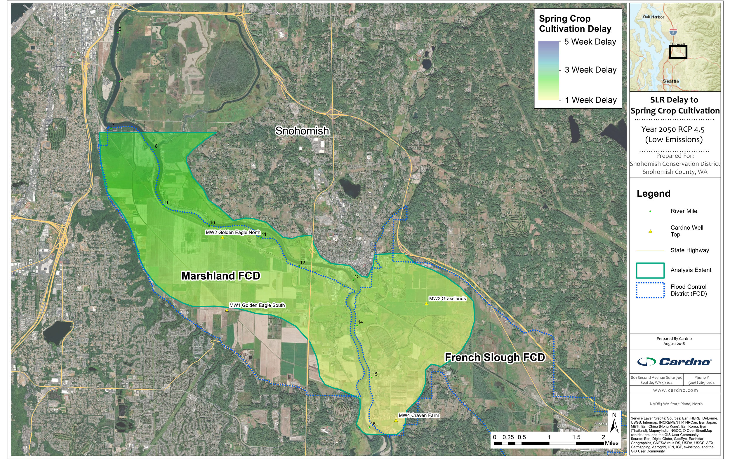
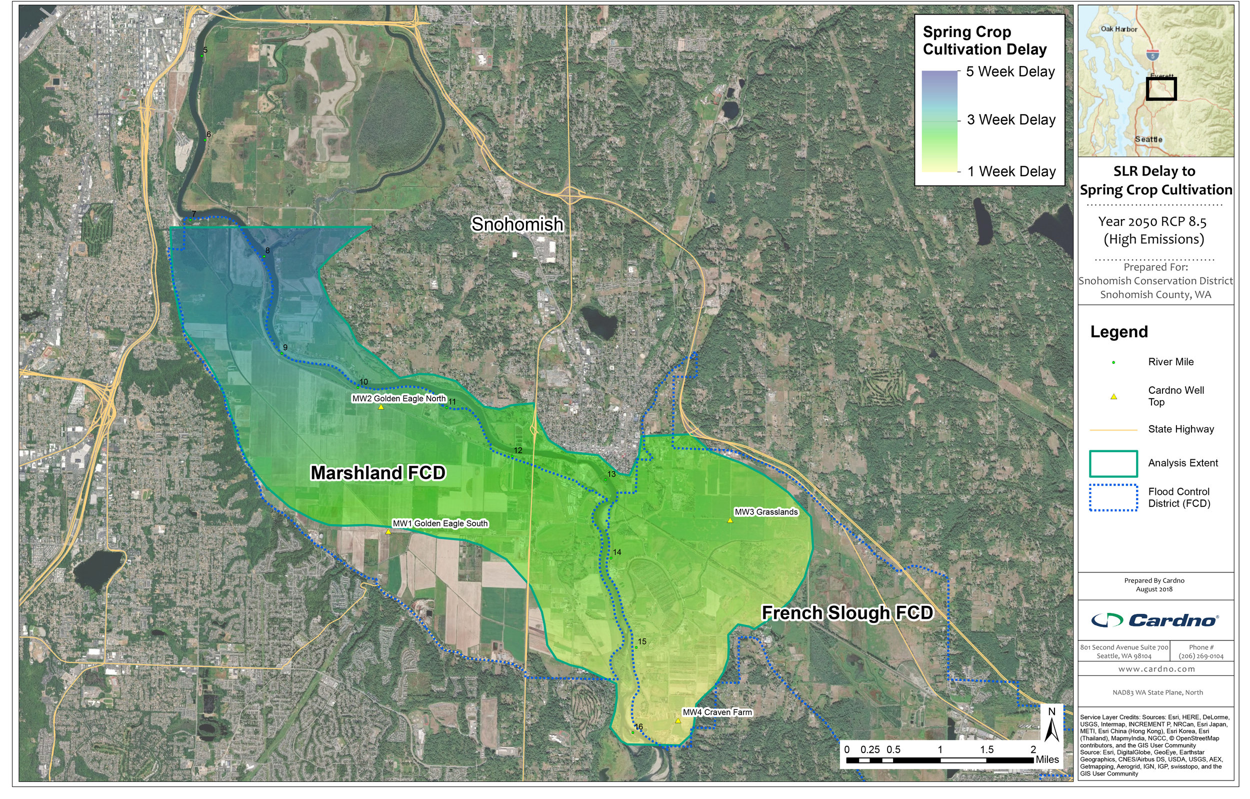
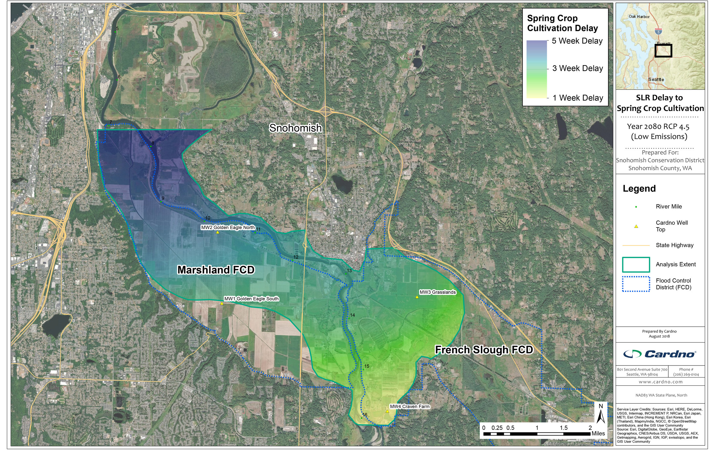
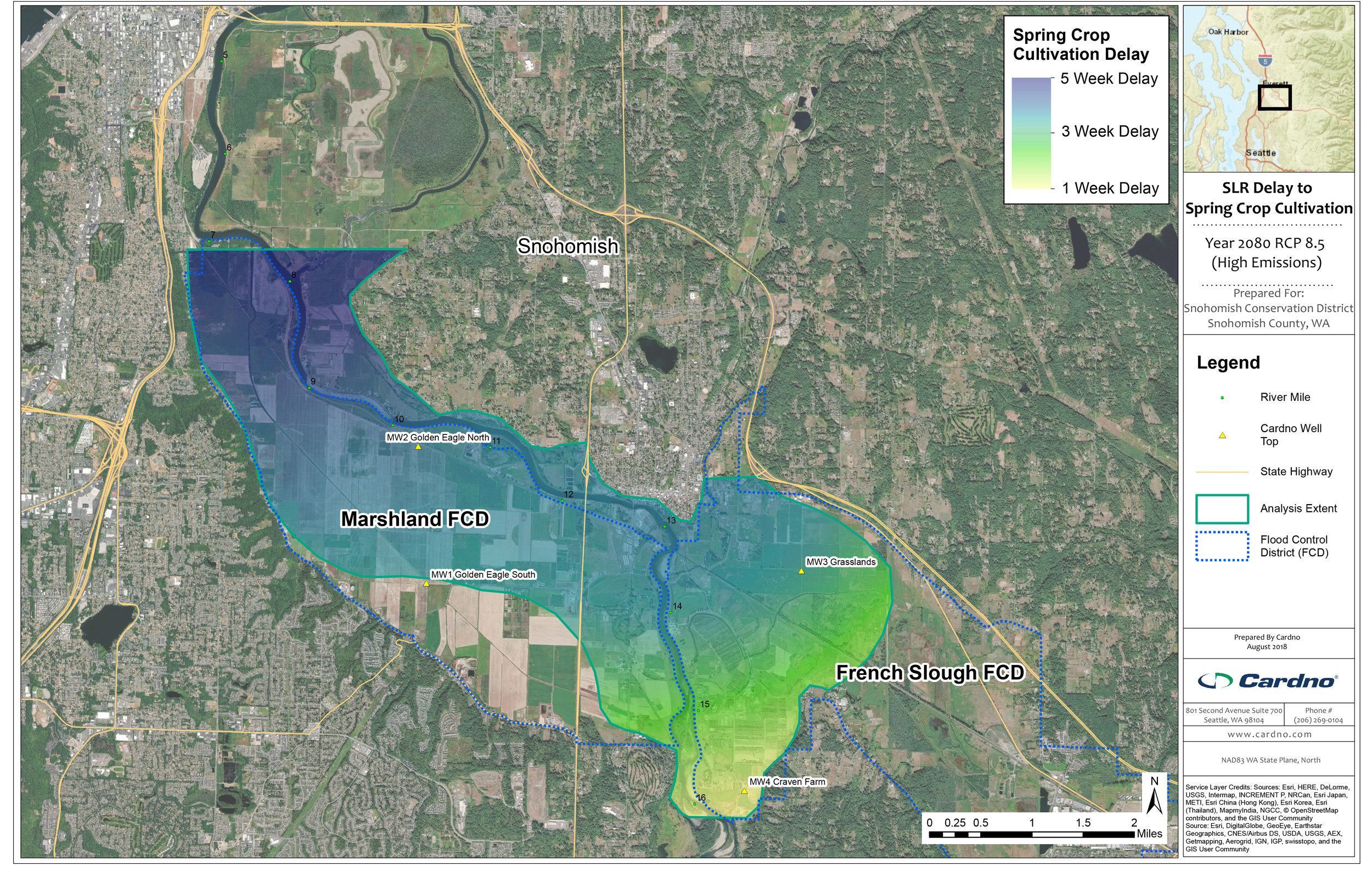
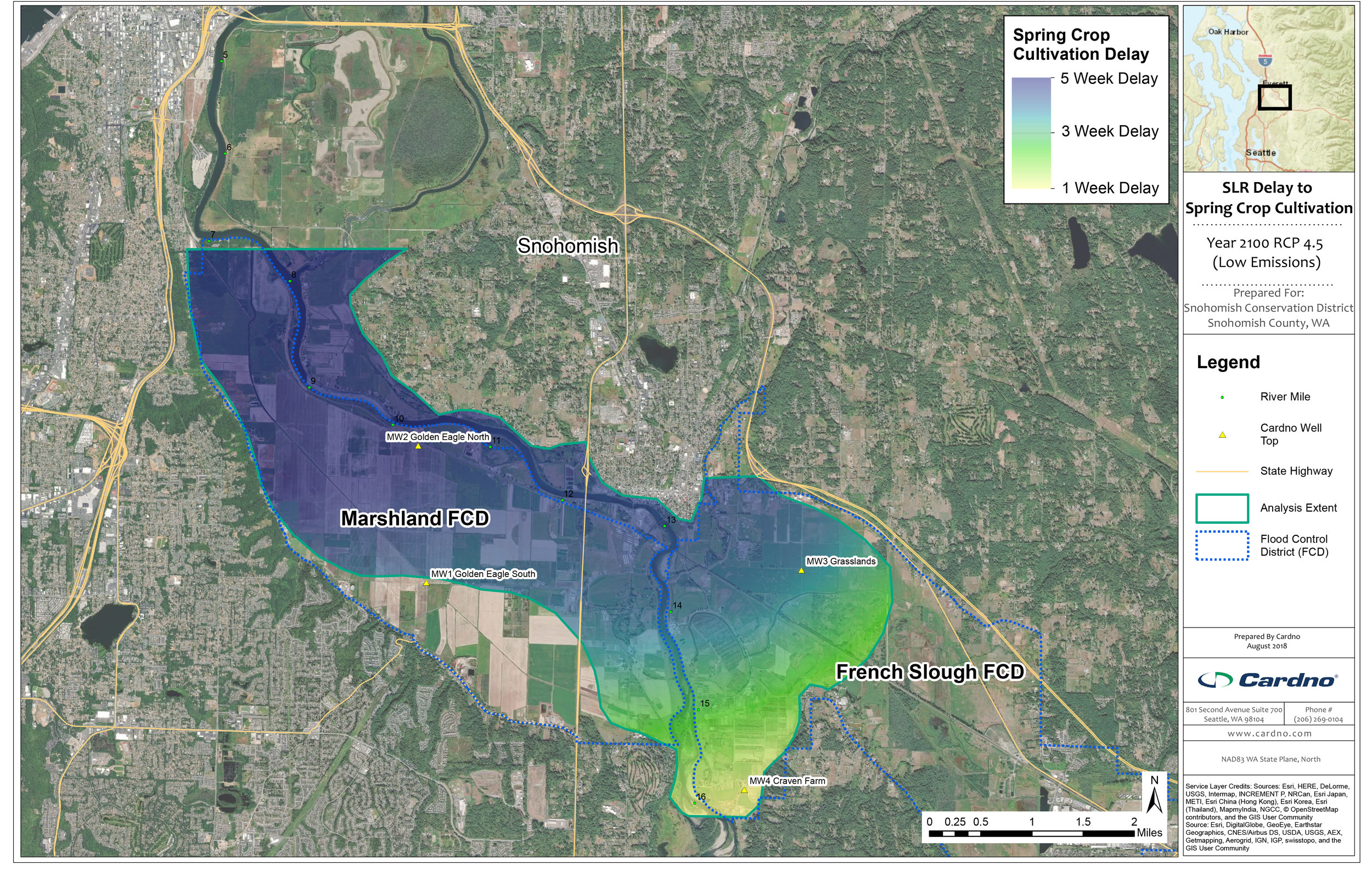
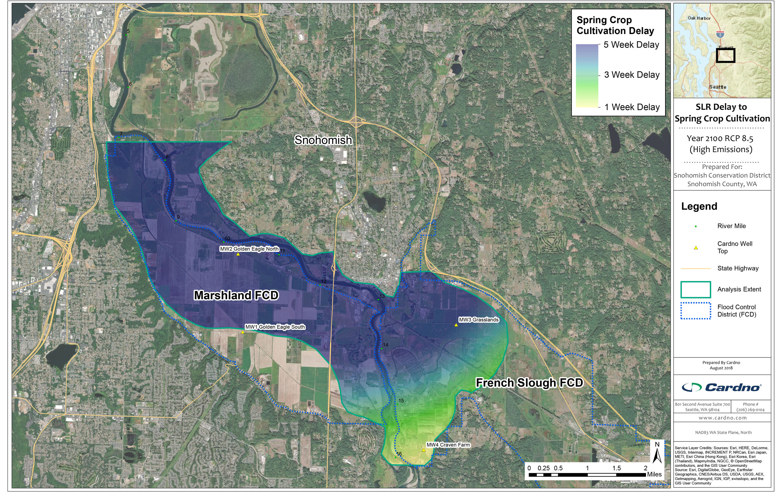
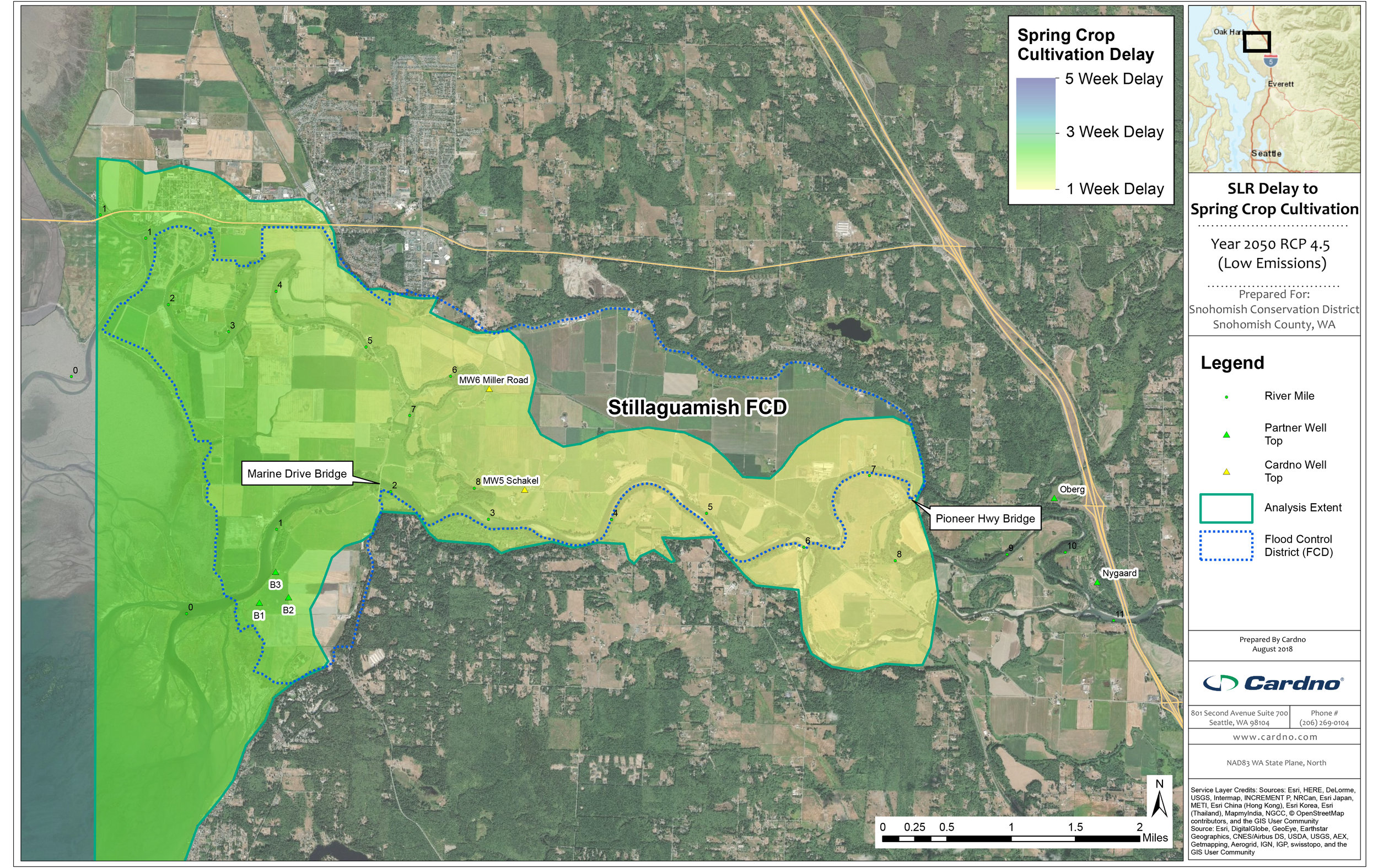
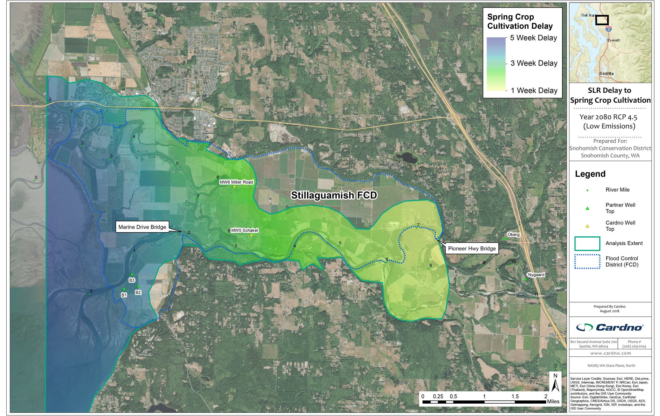
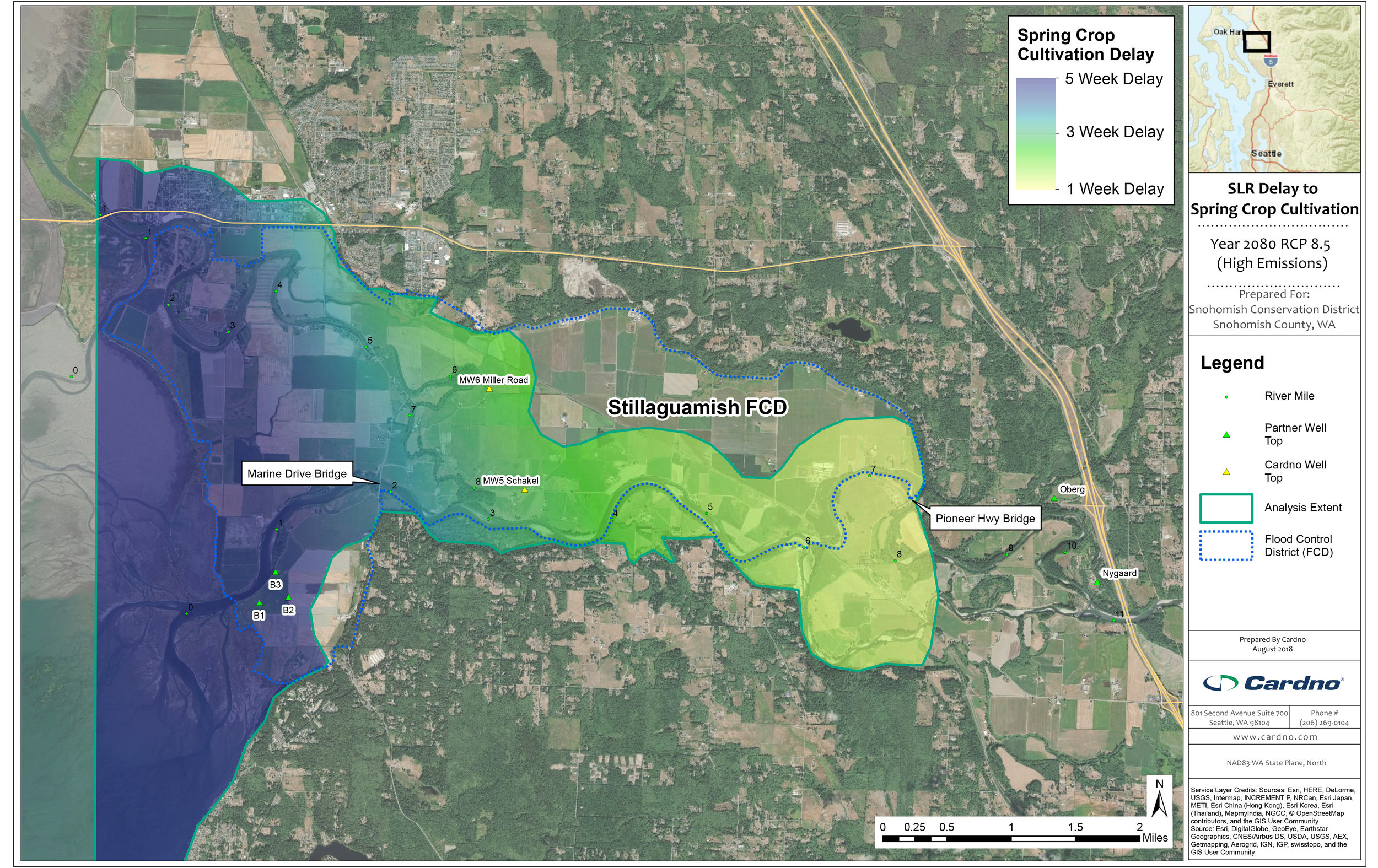
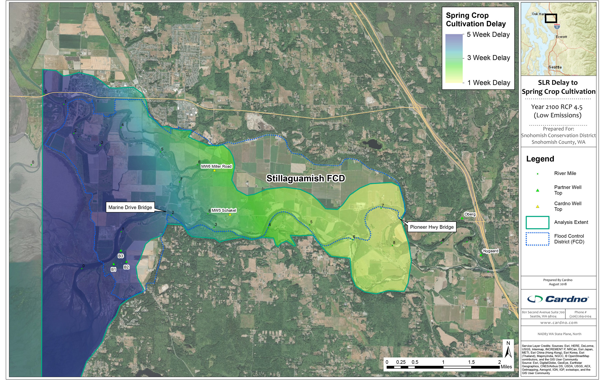
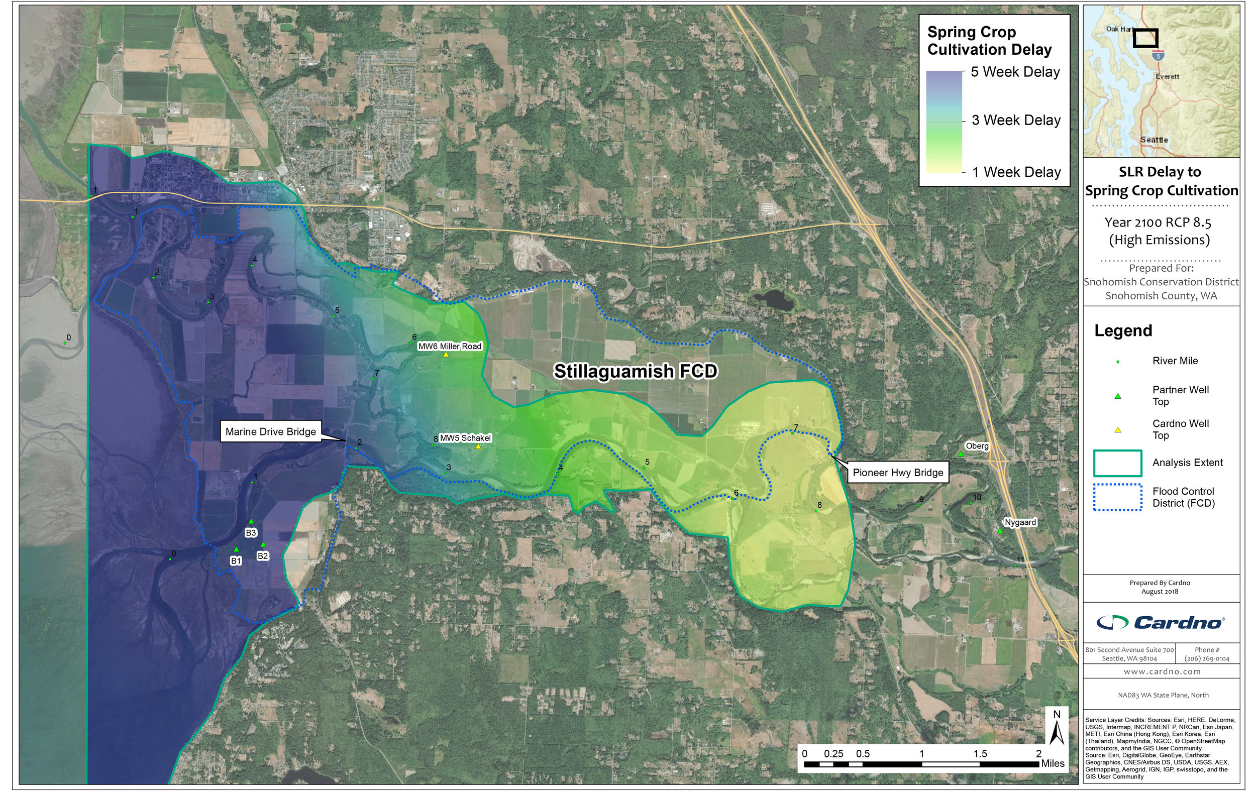
Sea Level Rise Impacts to Groundwater Levels
Sea level rise is projected to increase the height of the groundwater table into the future. Using groundwater level data from various wells throughout the floodplain, Cardno developed the following delay maps. The colors show the expected delay (in weeks) when farmers will be able to begin working their fields in the spring due to high groundwater tables. Please note: These maps do not take into account pumping and show the projected delay if the pump stations were not turned on. Also note, the Snohomish River maps stop just upriver of Ebey Island. Cardno found that a different mechanism is at work lower in the floodplain so created a separate analysis of groundwater impacts in the lower estuary. Please contact us if you would like to review those results.
Click the images to scroll left and right for a variety of examples.

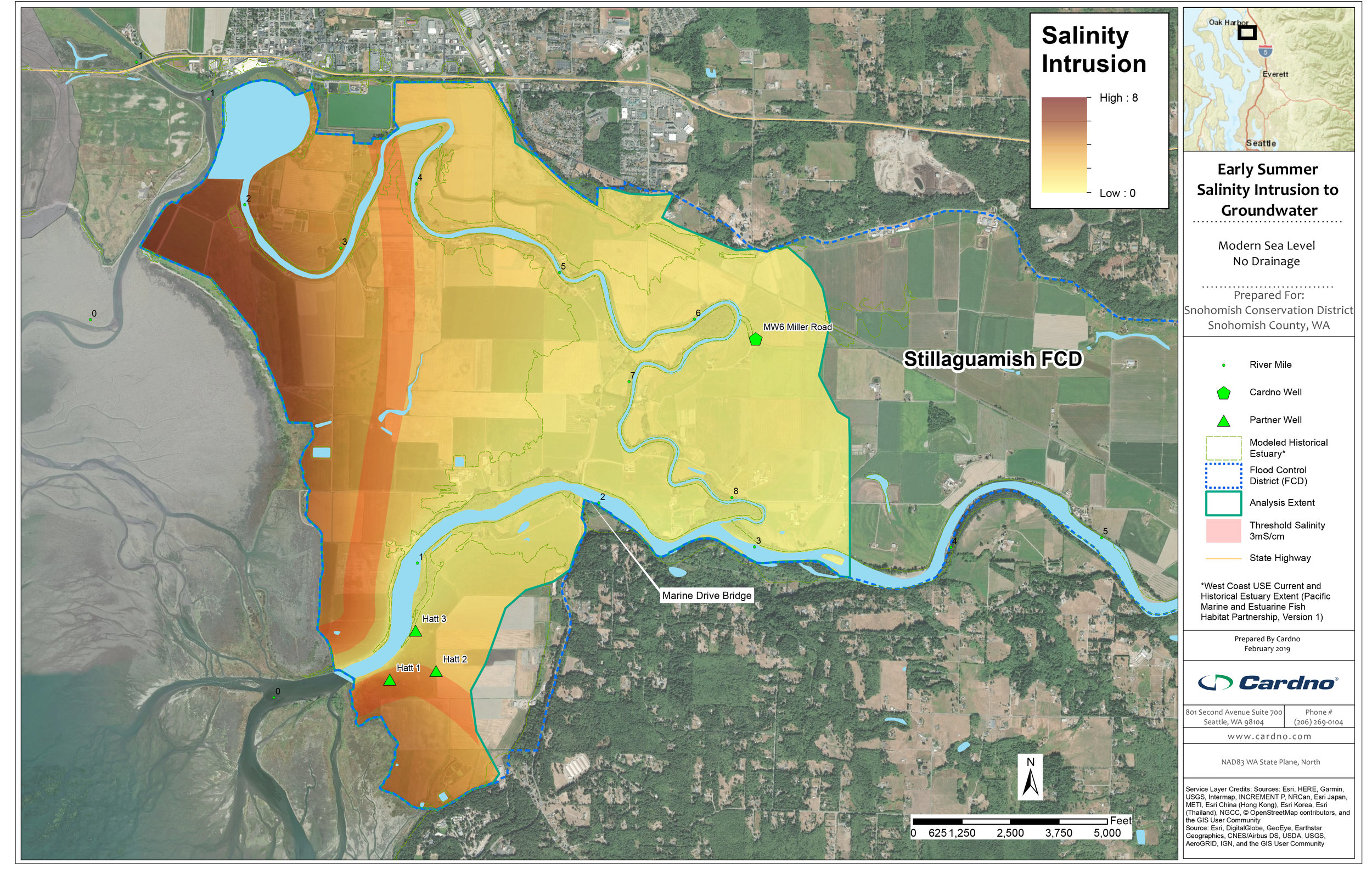
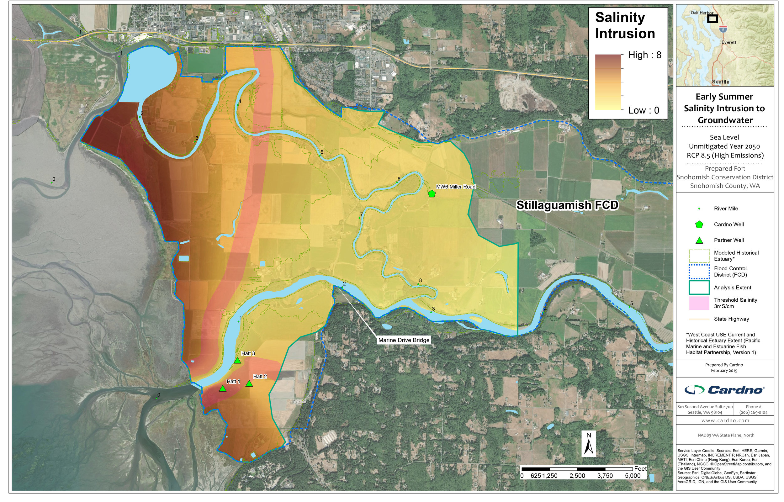
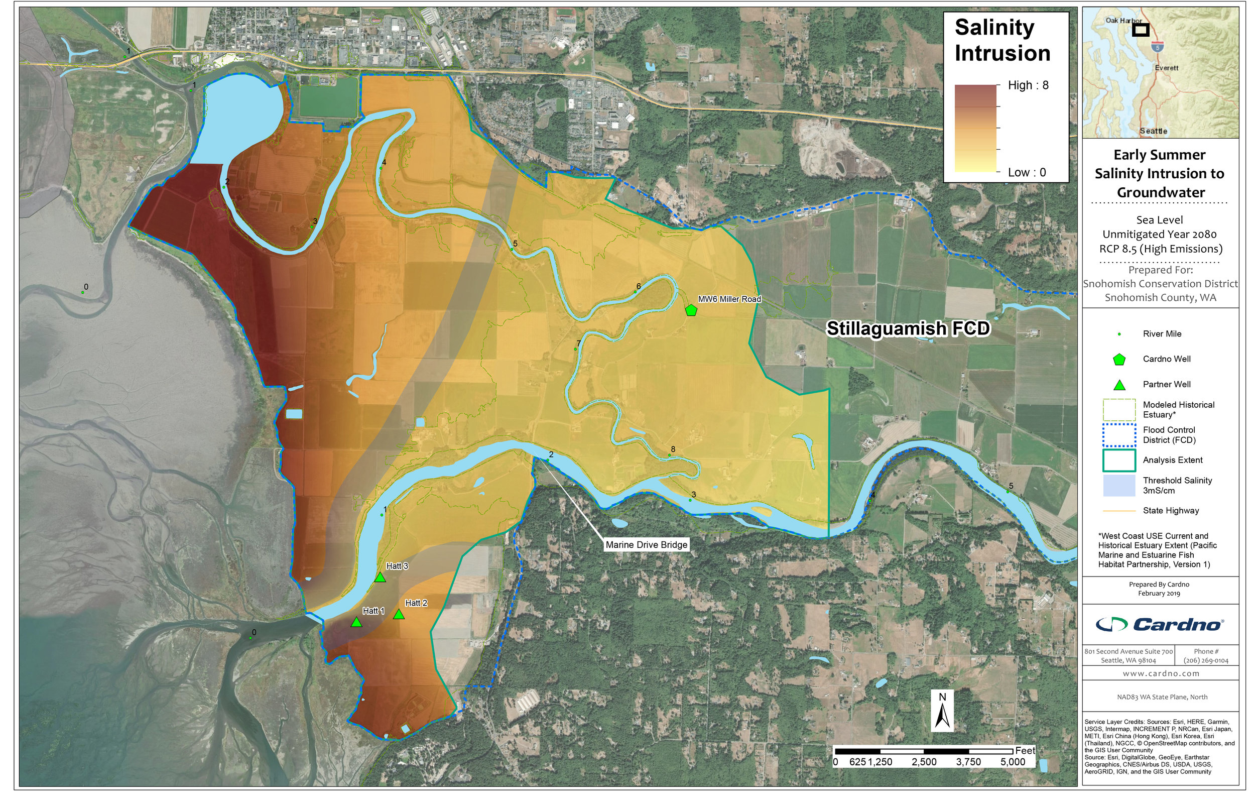
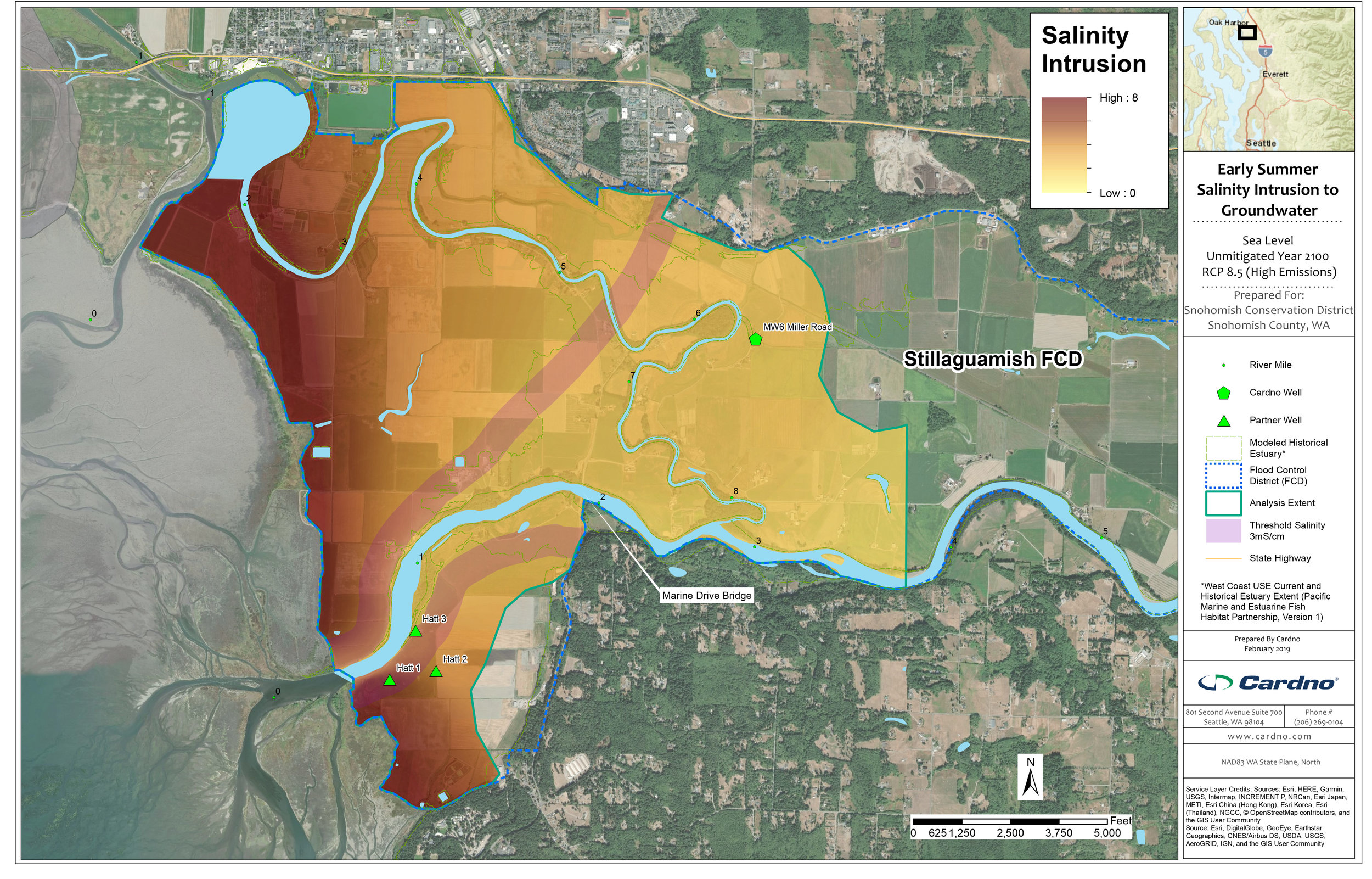
Sea Level Rise impacts to Saltwater Intrusion in Groundwater
Rising seas have the potential to increase the salinity of groundwater in agricultural areas and impact crop yields. Using groundwater data from various wells throughout the floodplain, Cardno developed the following salinity intrusion maps. The threshold for most crops currently grown in the Lower Stillaguamish River floodplain is 3mS/cm where crop yields are impacted. Using this threshold, the maps depict the gradual expansion of this “impacted” area upriver out to the year 2100. Note that maps for the Snohomish River floodplain are not included. The report below concluded that most agricultural land in the Snohomish River floodplain would not be impacted by saltwater intrusion due to the larger distance between active agricultural land and the sea.
Click the images to scroll left and right for a variety of examples.

MARK LONGSTROTH (MSUE)
Technical Report
The full report is 82 pages without appendices. Click on the image to download it as a PDF or click on the button below.
Brought to you by:


Funding provided by: National Estuary Program, NOAA, Stillaguamish River Lead Entity, Estuary and Salmon Restoration Program, and Floodplains by Design
